Desert scenes

The Mojave Desert is a challenging environment for living things with its cold winters, extreme hot summers, and lack of water. But it is an interesting place to visit nevertheless because of its stark scenery, weird vegetation, and the odd formations found off the beaten path. We took a detour on a loop road through the Mojave National Preserve in southeastern California and found the following interesting scenes that really deserved a longer look — but unfortunately not this time.

One of the entrances to the “Hole in the Wall” trail, an area of gas-filled lava deposits that wind and water have carved into strange and fantastic formations. The trail winds around and drops into a narrow slot with “holey” walls. It’s called Banshee Canyon because of the noise the formations make when the wind blows through them. To exit the canyon, you climb the walls with the assistance of rings set into the stone. A fun activity for old people like us??
The twisted, spiky, asymmetrical Joshua trees aren’t really trees. They are very tall yuccas, members of the Agave plant family. Their tough exterior and complex arrangement of leaves make good nesting and roosting sites for many animals.
A unique site in the desert landscape in the Mojave are the Kelso dunes which formed from the wind-blown sediments of former lake bottoms in this area. Although the dunes don’t look big or expansive in this photo, they are 600 feet high and cover 45 square miles. A unique community of animals and plants inhabit the dunes.
Who would imagine finding a big railroad depot in the middle of the Mojave desert? The Union Pacific railroad built the depot in early 1900s to serve trains running to and from Los Angeles ports. Kelso was at a point in the line where the trains needed supplies and helper engines added to the train to get it over the steep grade. Now the 120 year old building is a Visitor Center. The palms are the original trees planted here when the depot was built.
Granite boulders along the road were an excuse to stop for a snack and a quick hike. In other areas the granite was much more rugged, with fractured slabs, spires, and upturned blocks.
Another view of the granitic formations in the Mojave Preserve.

So many places to explore in what looks from the highway like just more boring desert, but driving the back roads reveals a wonderland of places to see.

From “Bad Country” to Big Nose Rock

South of Interstate 40 in western New Mexico are a series of reservations and scattered National Monuments, inviting us to do a little off-road exploring.

Four distinct volcanic eruptions from around 1500 BC to around 900 AD have left a landscape of rocky, cracked lava fields in the Malpais (literally “bad country”) area. Nevertheless, a trail over the lava fields allowed people of the Acoma, Laguna, Navajo, and Zuni tribes to navigate routes for trade and social gatherings for hundreds of years. Spanish explorers that came later to this area usually skirted it to avoid traversing the lava fields.

Difficult walking, to say the least!
Then park Service has paved portions of the trail to allow visitors to walk through the area.
Ponderosa pines seem to be able to grow in the lava fields, where sufficient erosion has occurred and soil has been deposited.

Further down the road was another interesting geological feature, a set of giant sandstone cliffs, one of which was named El Morro (the nose). This monument was closed when we visited, but what is of interest to tourists here is the history of the visitors to the rock. Names of visitors are carved into the base of the sandstone cliff, so that, like the pages of a history book, the rock reveals the succession of early Puebloan people, the Spanish explorers, the U.S. military, and then its designation in 1906 as a national monument by Theodore Roosevelt.

View of El Morro from the road
This side of the rock bears the carvings of visitors since about 1100 AD. You can just barely make out some etchings from this distance.

Prairie birds and National Grasslands

On our way west, we visited Quivira national wildlife refuge in south central Kansas and Cimarron national grasslands on the border of Colorado, Oklahoma, and southwestern Kansas. There were no wildflowers out, no mammals grazing the prairie, and few birds active.

A Northern Harrier coursing over a grassy area in Quivira National Wildlife Refuge.
A female Harrier getting right down on the tops of the grass stems to hear or see mice moving through the grass.
A small Sharp-shinned Hawk rested on a tangle of cottonwood branches in Cimarron national grassland, waiting for the unsuspecting sparrows to fly by,
While overhead, the “sharpy’s” much larger relative, a Cooper’s Hawk, circled the same patch of downed branches.

But we did learn about the importance of the Sante Fe trail, 23 miles of which runs through the Cimarron grasslands. This was a main route of commerce in the early 1800s, especially after Mexico won its independence from Spain, so that goods could be brought from Mexico all the way east to Independence, MO, and vice versa. 

The Sante Fe trail arcs around the base of the high promontory called Point of Rocks. In the distance the Cimarron River is bordered by cottonwoods, and the Cimarron grasslands stretch off into the distance.

Travelers on the route were always looking for good spots to stop for water and trading, and Native Americans showed them the landmark (Point of Rocks — literally, exactly what it still is today) that marked a set of natural springs nearby. 

A different view of the Santa Fe trail, the Cimarron River lined with trees, and the rocky promontory. The river water often dried up in the summer, but the springs had water all year-round.

We did see a few small birds, in addition to dozens of Harriers and other hawks, and the Lapland Longspur was a new species for us. 

Lapland Longspurs are striking even in their winter “dull” plumage. We should have been able to see this species in Finland and Norway last summer. They are the only North American Longspur species to breed all across the Arctic in the summer, where they gobble up thousands of seeds and hundreds of insects daily. They spend the winter in the lower 48, hunting for seeds along roadsides, which is where we found this bird.

A super-flock of Snow Geese

Near the Maxwell wildlife refuge outside Canton, Kansas, there are several crop fields with corn stubble that Snow Geese seem to like. I’ve seen these white geese several times in other places in the winter, always along with several thousand Sandhill Cranes. But near Canton, there were enormous flocks of Snow Geese flying from one field to another continuously, and if I could have added up the numbers of birds in all the flocks I saw, it would have amounted to tens of thousands of birds. For illustration of the multitudes of Snow Geese in just one flock…

They are very skittish birds, and take off en masse if we get just a little too close.
It’s amazing they don’t hit each other with their long wings.
There was a lot of honking, and flying in circles before they settled down again.
Then even though they had barely settled on the ground again, they launched themselves skyward again, as we moved too close in the car.
It’s a trick getting just a few birds in one image. 
One of the rare moments when they were on the ground for more than 10 seconds.

You might wonder why they are so flighty?

Although their population was steadily decreasing in the early 1900s due to hunting pressure, they rebounded to record numbers while under protection, so that there are now more than 5 million birds breeding in the arctic each summer. Needless to say, their breeding habitat has become severely degraded with this much goose activity on it each year. To control the damage (and the potential harm to other species nesting there), the length of the hunting season and bag limit for the geese have been increased for a sustainable harvest of their numbers. And so they naturally flush at the sight or sound of an encroaching hunter, every time they see or hear one.

Wildlife on a Kansas prairie

We visited the Maxwell wildlife refuge near Canton, Kansas today and were very lucky to see a large herd of almost 100 bison, and 20 or so elk, resting on a hill in the almost 2600 acre refuge. 

The bison were doing more standing around than grazing, but there was little snow on the ground here so I’m sure they had ready access to the dry grass.
The land here originally belonged to Henry Maxwell, who settled the land in 1859 and dreamed of establishing a large refuge here in the tall grass prairie. His youngest son brought the dream to fruition by providing funds from his estate to purchase the land for the refuge in 1944. The herd, now numbering 150 animals, was started with a purchase of 7 cows and 3 bulls from the Wichita Mountains NWR in Oklahoma in 1951. A small herd of elk, which were once common in Kansas, was also purchased for the refuge.
A small group of cow elk rested in the grass near the bison herd. 
The bull elks rested nearby but separately from the females.
The main road through the refuge has high buffalo fences alongside it and cattle guards at strategic spots to prevent the animals from wandering onto the road. But 2600 acres to roam in seems to keep the buffalo here happy. I didn’t realize when we drove the length of the refuge how much area it actually covered. The bison and elk could have been hidden in any of the draws or behind hills or trees, and we would never have seen them.
Lucky for us, the grass on this side of the hill was more enticing.

In a class by themselves – the best of the best of 2023

Sometimes the landscape is just so spectacular, the photos are in another class by themselves. And that was the case when we visited Val Gardena in the Dolomites of northeastern Italy. The views around our little hotel were out of this world, and even the grandkids, who are used to some amazing mountain views when we backpack in the Sierras of California, gaped at the scenery.

A view of the big monolith, Sassolungo, from the porch of our hotel.
The view at our Hotel Cir (cheer) in the mountains above Val Gardena.
Another view of Sassolungo and the group off to hike another trail.
Imagine this: you step off the chair lift, walk up a small hill for a view, and this is the scene that greets you. It’s breathtaking!
Alpine Rhododendron bushes in full flower carpet the surfaces of the rocks in August.
And here are the intrepid hikers — backdrops for family photos don’t get much better than this!

Best of the landscapes in 2023

We had a wild year of travel in 2023 and visited some beautiful places, some more than once. It’s hard to choose “the best” when each location was different and spectacular in its own way, but here’s a taste of what we saw. 

Snow Geese at Bosque del Apache, NM, January 25.
A fiery river of flowing rock at Valley of Fire, NV, January 27
Teetering rocks at Chiricahua National Monument, AZ, February 13.
White on white at White Sands National Park, NM, February 14
Magenta light at dusk in the Valley of Fire, March 31.
Evening light at the Grand Canyon south rim, AZ, April 1.
Saguaro at sunset at Apache Junction, AZ, April 6.
Cormorants, pelicans, and wildflowers at Point Buchon in central CA, April 29.
Summer scene in the High Fell of Finnmark, Norway, June 4.
Sunset in St. Mark’s Square, Venice, July 27.
Evening walk above Vernazza, Italy, August 4.
Avenue of the Baobabs, western Madagascar, October 9.

Baobab — a different way to build a tree

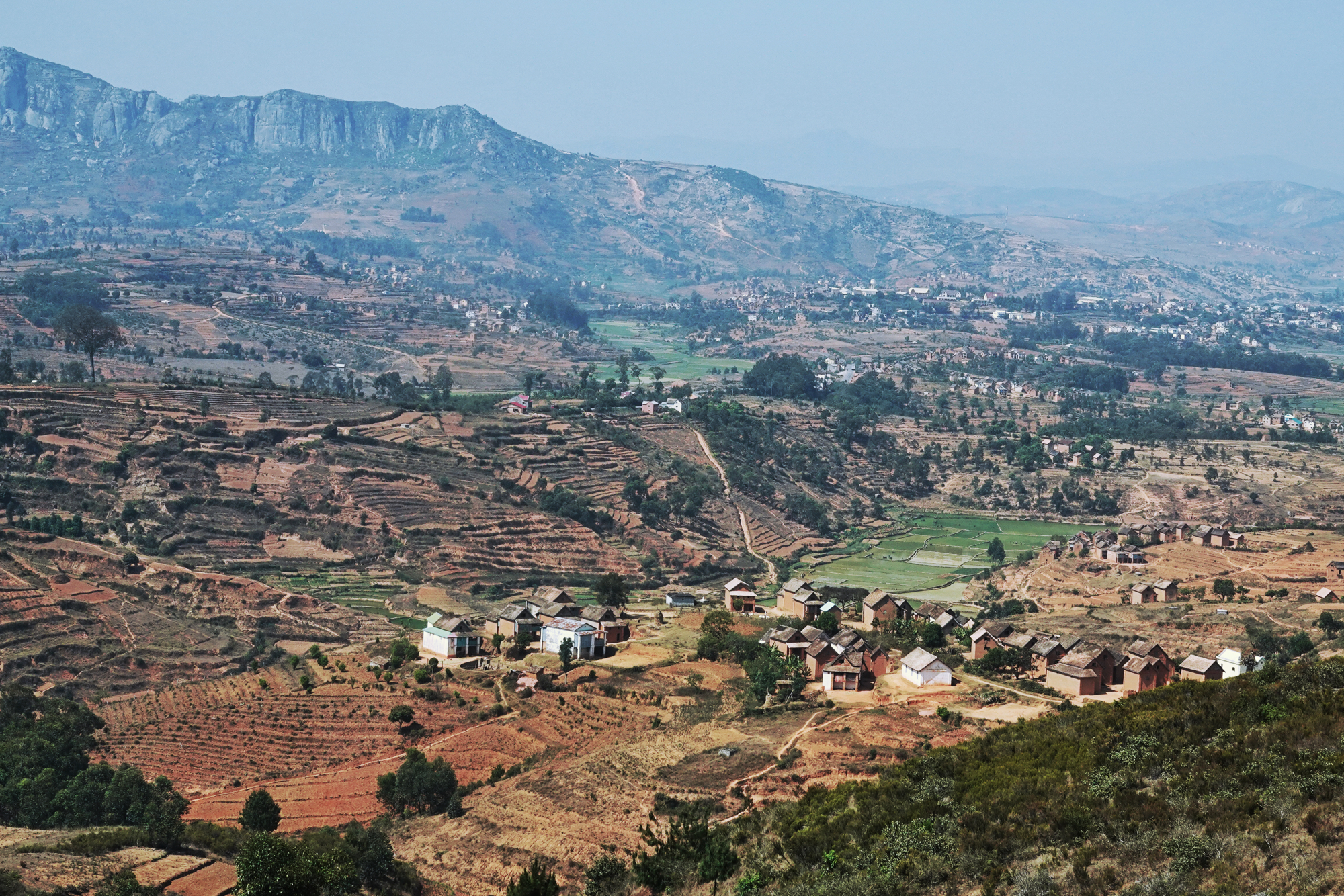
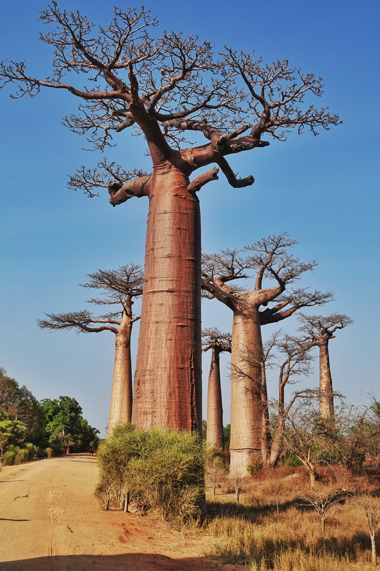
Madagascar is home to 6 of the 8 existing species of Baobab in the world.  Here in the Avenue of Baobabs, near Morondava, Madagascar, individuals of three Baobab species are the remnants of the dry, deciduous native forest that has been replaced by agricultural fields.

Baobab are often called bottle trees, or upside-down trees, for their strange, thick cylindrical shapes that taper at the crown before branching into what resembles a mass of roots that are actually its branches.

A lone Baobab tree still standing in a Malagasy farm yard.

Not only is their structure unique and remarkable, but their annual phenology (cycle of leaf, flower, fruit production) is as well.  The trees shown here flower during the dry season from May to August, but each flower lasts less than a day, and the entire flower production of the tree may last less than a week.  Leaf production follows during the wet season from October to May, which marks the period of tree growth and fruit production.

Flowers burst into full display from buds within a few hours, displaying creamy white petals below a huge mass of anthers (yellow-tipped filaments in the image).  All the pollen is released the first night the flower is open.  The floral perfume and nectar attract huge numbers of pollinator visitors:  hawk moths, fruit bats, birds, and mouse lemurs.

The fruits are dry, but full of vitamins (C and B6) and sugars. They are protected by a thick shell, but some baobab species drop the fruit from the husk at ripening, making them available to birds and mammals on the ground.

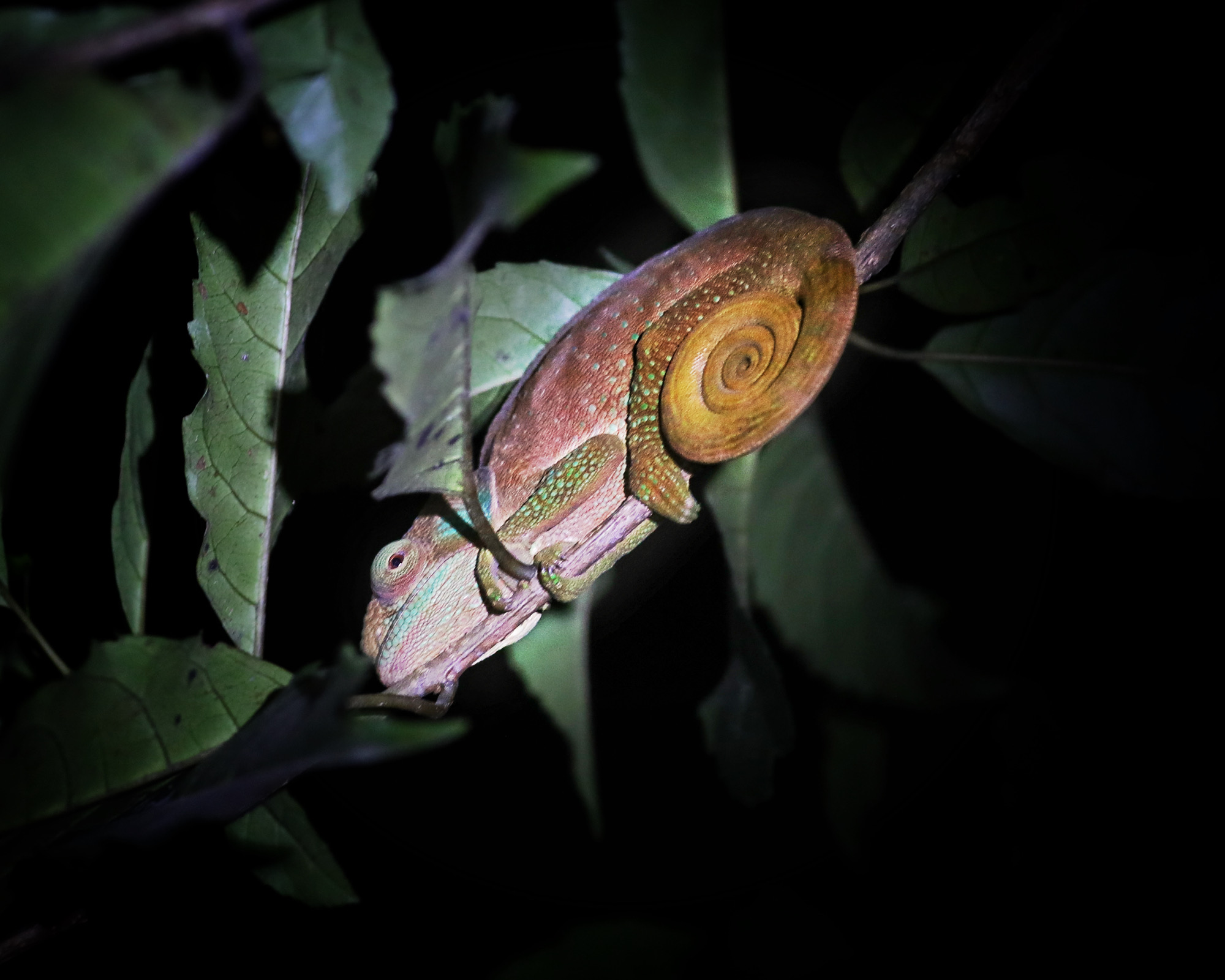
Baobab also provide roost and nest sites for a variety of animals: the dense array of their branches are ideal platforms for nesting birds, for example, and we did see a few species cruising the tree’s upper architecture, perhaps looking for the perfect spot.

A Sickle-billed Vanga poked around a bit, maybe hunting for insects, or a nest site?

Sakalava weavers flitted through the low bushes and over the tops of the Baobab. Weavers build remarkably complex nests in trees, but I don’t know if Baobab is one of their preferred nest sites.

But the most intriguing thing about these unusual trees is why they look like they do!  Is the shape really an adaptation to life in an arid landscape, with the trunk acting like a water reservoir in times of drought?  Do the trees use the water in the trunk for photosynthesis to build flowers, leaves and new branches?

The trunk diameters are impressively large, more than 9 feet in this tree (according to the 6 foot person standing next to the base). And the trunk supports a massive weight of tree that may reach 100 feet or more in height.  Baobab grow very, very slowly.  The giant is probably hundreds if not thousands of years old, while the young sapling may already be dozens of years old.

Researchers from the Missouri Botanical Garden and the Kirindy research station near Morondava, Madagascar, investigated this question and found some striking departures from the traditional assumptions about “water storage” in Baobab.  Most important, they documented that less than 10 percent of the water in the spongey, water-laden central mass of the trunk actually moved upward to be used for photosynthesis by the leaves.  Well, then, what’s all that water for?

Humans were unsuccessful in cutting down the Baobab when they cleared the dry forest. They simply couldn’t cut through the incredibly thick outer bark.

Living in a nutrient-limited, water- limited forest environment meant that Baobab trees would need to economize on wood production in order to grow tall as quickly as possible.  So, these trees use a combination of outer bark strength and turgor pressure of the water in the interior spongey cells to maintain a rigid column, rather than putting energy and material (e.g., synthesizing lignin) into production of wood.  If they lose too much of their interior water, the trunk will collapse under its own weight, so the interior water reservoir remains full. Basically, the larger the base of outer wood and inner water-filled space, the greater the strength of the column for support.  The interior “water reservoir” is a biomechanical stiffening agent.

Their girth and their height are truly amazing.

Baobab are dry forest survivors in this part of Madagascar, but the Malagasy people call them “mother of the forest”. Their iconic shape reminds us of the many ways that “life will find a way” (a la Jurassic Park)

Madagascar highlights

We’ve just returned from a two week adventure in Madagascar, during which we visited a variety of humid tropical forest and dry forest habitats in a few of the 19 national parks to see some of the country’s endemic species of lemurs, reptiles, plants, and insects.

There are over 100 lemur species in Madagascar, all of which evolved on the island from a single ancestor that found its way there after the island separated from Africa and India. The Golden Bamboo Lemur is one of the rarest and most endangered.. First discovered in 1986, its presence, along with other critically endangered fauna in the same area, led to the formation of Ranomafana National Park in 1991.

Ring-tailed Mongoose or Vontsira, medium sized weasel-like mammals, are one of the ten species of carnivores in Madagascar. Some scientists believe that all Madagascar carnivore species evolved from a single ancestor that may have rafted to Madagascar from Africa.

Photo from Wikipedia

There are 283 bird species in Madagascar, 40% of which are endemic to the island. This means Madagascar has the highest percentage of endemic bird species in the world at this time. However, many species are on the EDGE, literally and by category (evolutionarily distinct and globally endangered).

The spectacular Paradise Flycatchers are widespread in Madagascar but are also found in the Comoros Islands, I.e., it is not endemic to just Madagascar. They are relatively common in all forest types except montane, and are one of the few bird species of least concern on the island.
Crested Coua and eight other Coua species are all endemic to the island. They are jay-like in their behavior, even sounding like a Jay, but are related to cuckoos. They are rather weak flyers and hop between ground and low branches rather than flying in the dry deciduous forest.
Malagasy Kingfishers are one of two endemic kingfisher species. Only 5 inches long, their brilliant coloration nevertheless makes them stand out in their wetland habitat.
All 72 species of chameleons are endemic to Madagascar. The Blue-legged Chameleon, also known as the cryptic chameleon, can change its brilliant colors into dull brown to avoid detection.
The Madagascar Collared Iguana is not related to iguanas of the Americas, but is in a separate family. They do act like iguanas though and can be found on the trunks of trees as well as the ground in the dry forest.
Madagascar Brilliant Blue is a nymphalid butterfly found on many of the islands of the western Indian Ocean. There are more butterfly species (300+) than bird species on Madagascar, about 210 of which are native just to Madagascar alone.
Insects like the Giraffe-necked weevil may have been blown from Africa to Madagascar. This odd little beetle has a long tubular neck used for fighting in males.
Baobab alley on the western coastal area of the island features the giant baobab trees that are remnants of the dry deciduous forest that used to be here. The tough, thick bark at the base of the trees resisted the “slash and burn” efforts of the farmers to clear the land here, leaving them standing among the rice paddies.
There are over 900 Orchid species in Madagascar, an astounding 83% of which are native to the island.

The astounding biodiversity in Madagascar is a product of its long evolutionary isolation and its diverse topography. Central highlands (up to 8000 feet) drop off to the east where a wet climate produces lush tropical rainforest along the length of the island at mid and low altitudes. To the east, the rain shadow effect of the highlands results in a series of rolling hills of grasslands, eventually giving way to dry deciduous forest along the west coast and spiny forest at the southern tip. So many environments, so many niches to fill, so much biodiversity.

But this amazing biodiversity is fragile and vulnerable to the presence and actions of humans that have colonized the island for the past 2000 years and have transformed the landscape for agriculture.

Hillside forests are gone, replaced by terraces of rice paddies and vegetable gardens. (Click on the photo to enlarge the view.)
Men spade up the ground after harvesting to start another crop. The land is continually in production, aided by irrigation from local rivers.

Loss of habitat, especially removal of trees that provide food and protection for animals, is a major threat to Madagascar’s biodiversity. Add to that the pressure from a rapidly growing and expanding human population (30 million in 2023) and increasing extremes in weather that have changed the periodicity and extent of wet and dry seasons. The challenges to protect biodiversity are enormous, and risk of failure is high. Species facing the greatest threats (according to an article from the journal Science in 2022) are fish, mammals (especially lemurs), amphibians and mollusks, as well as a wide variety of plants.

EP= extinct before 1500 CE. EX= extinct after 1500 CE. EW = extinct in the wild. CR/PE= critically endangered, possibly extinct. CR= critically endangered. EN= endangered. VU= vulnerable. NT= not threatened. LC = least concern. From Ralimanana et al., Science, 2 Dec 2022.

Adventure in Eden

A couple of days into the Madagascar adventure now, and we’ve begun to appreciate the struggle between humans trying to survive and pristine nature trying to persist here. Recent conservation efforts have begun to preserve a lot of what was left after human exploitation of this unique island over the last few hundred years, and we hope to see a lot of that in the coming weeks. But for now, the view has been limited to the contrasts within the capital city of Antananarivo.

The view behind our hotel is one of extreme poverty, one room sheds, and crowded, probably unsanitary conditions.
While the view on the other side of the hotel features better looking housing, soccer fields, and lagoons that should have some wildlife (but we haven’t seen it).
Four-lane main roads carry all of the mid-day traffic, which varies from people transporting goods by cart, to bikes, motor scooters, cars, and trucks. Needless to say, traffic snarls make progress on the road extremely slow.
Local commerce with small stands for food, clothing, and other household goods block the sidewalks, so it isn’t really feasible to walk to a particular destination either.

One can get some respite from this scene by visiting some of the nature parks in the city, one of which was close to our hotel (about 2 km, or 1.2 miles) but took 25 minutes to drive there. Tsarasaotra Park is a private nature reserve established in 2001 by a family interested in the preservation of this area. Visitors pay an entrance fee to gain access to the hiking trail.

An island in the middle of the lake has dozens of Snowy Egrets, Squacco Herons, and Black Egrets nestled in the bushes and trees, as well as a huge number of ducks resting on the banks.
Bamboo and Eucalyptus provide nice shade on the walking path around the lake.
The lake is just teeming with ducks spreading out in an even layer over the entire surface of the shoreline.
Impatiens grow here into small shrubs, with thick woody bases.
Pointsettias here are trees! Jacaranda were also in full bloom.

The wildlife seems to tolerate us walking around the perimeter of the lake near them, so we got some good photos of a few of the species.

White-faced Whistling Ducks were very sedentary, mostly standing or sitting near the shoreline. They really do whistle, pretty much non-stop.
By far the most numerous ducks on the lake were the Red-billed Ducks.
About half the size of the Red-billed Ducks were the far less numerous Blue-billed Teal.
Squacco Herons were quite common on the island and we saw a few of them foraging out in patches of water hyacinth in the lake.
A few adult Black-crowned Night Herons sat near the shore of the lake, along with a couple of their juvenile offspring.
One exciting find here was the Malagasy Kingfisher, a brilliant little bird decked out in russet and deep purple.

Since Madagascar has been isolated from Africa, India, and Antarctica for so long, the wildlife that has survived human exploitation of the island is largely endemic, unique to just this place alone in the world. The kingfisher is just one of the many examples of endemic birds and other animals we will be seeing.